Temperatures: 36º F
Wind Chill: 29º F
Wind: 10 MPH E
Dew Point: 32º F
Precipitation: It's coming down hard as we speak!
The storm has begun! The snow is falling like crazy currently. I tried to get a good picture, but it didn't turn out the best. Expect a picture of the snow fall as the night goes on. There are several mighty factors that are fueling this massive snow storm. They include a powerful low pressure system, vast amounts of water vapor, and the polar jet stream. There are several other factors fueling this process that I will talk about as we progress further into today's post. The temperature is still very high for the time being as the low pressure system pulls air from the south and west into our region. We are projected to get around 12 inches of snow over the next day which is truly incredible. The University has already closed night classes and depending on how long the snow lasts it could potentially close tomorrow as well. Below is an image of the current temperatures in the Midwest.
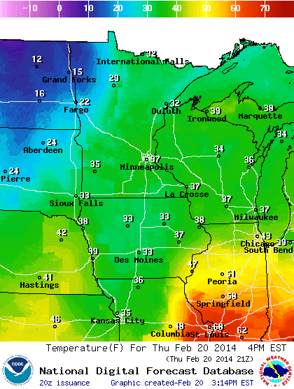 |
| Image 1: The image above shows the temperature in the Midwest. |
 |
| Image 2: The image above is provided by the GOES satellite and shows the amount of water vapor in the clouds. |
 |
| Image 3: The above image shows wind direction and speed in the Midwest. There are very high winds across the Dakotas and Nebraska. |
 |
| Image 4: The image above is provided by noaa.com and shows the different types of precipitation in the Midwest. |
 |
| Image 5: This image was provided by The Weather Channel and shows radar data, pressure systems, front and isobar lines. There is a massive low pressure system over the Midwest which is wreaking a snowy havoc. |
No comments:
Post a Comment